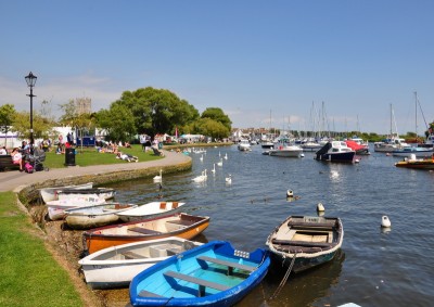
Christchurch Harbour
Christchurch Harbour is a large natural harbour with a wonderful variety of walks, watersports and other activities.
The Harbour was formed 7,000 years ago when the sea level rose at the end of the Ice Age. Christchurch Quay and Quomps lie in the upper reaches of the harbour and on the northern banks of the River Stour.
The entrance to the harbour is known as 'The Run'. You'll find Mudeford Quay to the north and Mudeford Sandbank to the south. Hengistbury Head separates the harbour from the sea.
Harbour Approach and Entry
The entrance channel is shallow and constantly changes making it difficult to define, especially in winter. Boats with a draught larger than 3'6" will have difficulty and local knowledge will be useful. The channel is marked by red and green buoys, positioned by local fisherman when necessary. Their accuracy cannot be guaranteed. Downstream of Mudeford Quay there are two vertical green lights marking the shoreward end of the channel joining 'The Run'. No bearings can be given because of the changing channel. 'The Run' is deeper and becomes congested in summer. Between high and low tide the water flow can be up to eight knots, or slightly less on a flood.Inside the harbour the narrow main channel, marked by buoys, is shallower than the entrance channel. Any deviations could result in running aground. The most favourable, deep water anchorages are to the north of Branders Bank or at Steepbanks.
Address
- The Quay
- Christchurch
- Dorset
- BH23 3NT
Contact
- Telephone: 01202 471780

